Sunday, October 14, 2012

Skilak Lake Fatbike/Kayak Combo

LOGISTICS:  Leave kayak at Lower Skilak, drive to Upper Skilak, ride fatbike back to Lower Skilak, transfer from fatbike to kayak, paddle to Upper Skilak, load kayak on truck, drive back to Lower Skilak, pick up fatbike, drive home.
DISTANCE:  14.3 miles
TIME:  3:05 hours

Fatbike at the Upper Skilak Lake campground sign.

The frosty view at Engineer Lake Overlook.

Fatbike at the Lower Skilak Lake Campground sign.

Paddling across a nice and calm Skilak Lake.

A self-portrait, or 'selfie,' as I have heard them called.  As you can see, I stayed very close to the shore since I was by myself.

Frost and ice form on the bow of the kayak.  It was 22 degrees.  Chilly.

At the finish line.
I have wanted to do this particular loop for a long time.  The weather forecast looked good, so I woke up at a wee hour in the morning made the drive out to Lower Skilak Campground.  That's where I stashed the kayak before driving to Upper Skilak Campground where I parked the truck, unloaded the fatbike and hit the gravel.

The riding was easy, albeit cold, and I enjoyed cruising down the road.  After about an hour-and-fifteen-minutes I was back at the kayak. The fatbike and kayak traded places and I was soon paddling across a flat calm Skilak Lake.  I stayed close to shore and saw numerous eagles, ravens, and waterfowl.  It seemed like I had the entire lake to myself as I didn't see any other watercraft or people along the shore.  I wasn't in any hurry so I would paddle twenty strokes and let the kayak drift until it stopped making forward progress.  I spent a lot of time just looking around but still made the six miles between the campgrounds in under two hours.

When I got to the boat ramp at Upper Skilak Lake campground I saved the tracks from my trip on the GPS and loaded everything up before driving back to Lower Skilak to pick up the fatbike.  Clouds were moving in and a breeze was beginning to create ripples on the surface of the lake. 

At Lower Skilak Campground I picked up the fatbike and visited with some birdwatchers that I know.  They were participating in an event called The Big Sit.  It's a nationwide event where participants stake out a 17 foot diameter circle and count all the species of birds they see or hear in a 24 hour period.  They had 23 species when I talked with them at noon.  They were hoping to get about 10 more and planned to stay until 8:00 PM.  It was kind of neat to see all the spotting scopes and binoculars they were using.  High powered birders for sure.

I wished I could have stayed longer, but Laura's volleyball team had a big game and I had to hit the road in order to make it back in time to watch her play.  I was a little late but got there in time to see most of the games.  After spending the rest of the afternoon at the Nikiski High School gym I went home and unloaded the truck. 

The weather was changing.  It was cloudy and windy.  Just a few hours later it would be snowing.  Kayaking might be over for the season, which made me glad that earlier in the day I had done the...Skilak Lake fatbike/kayak combo.

Tuesday, October 2, 2012

...Slaughter Gulch Hike

THE ROUTE:  Trailhead behind Wildman's.  Up steep trail to gulch.  Back down.
DISTANCE:  ~3.2 miles RT
TERRAIN:  Steep. Sections of loose rocks and dirt.  Slippery when wet.
The Hufford girls at the start of the hike.
Laura and waterfall near the start of the hike.
Between the seasons.  Yellow leaves on the trees.  Snow on the ground.
Emily and Laura with Cooper Landing and the Kenai River far below.
At the top.
The Hufford girls begin the descent.  Kenai Lake is in the background.
September has not been a great month for hiking.  Between perpetual typhoons, volleyball games, and other obligations, there has been precious little time to get outside.  So, when Mrs. Huffy and I discovered that the Sunday afternoon forecast was predicted to be favorable (read: dry), and we had some hours to spare, we decided to squeeze in a hike on the last day of the month.  We loaded the truck with backpacks, boots, a pup, one 10-year-old, a teenager, and a full tank of gas (not cheap).  Then we barreled toward Cooper Landing and the trailhead at Slaughter Gulch.  Departing the trailhead at 1:30 PM, we took our time and made our way to the top taking lots of photos as we went.

The higher we climbed the sunnier it became and we enjoyed full on sunshine just as we crested the top of the trail.  We looked in earnest for a geocache that was supposed to be there, but gave up after 30 or so minutes of searching because we couldn't find it. 

Back down we went encountering the only other hikers of the day as we descended.  They had pristinely clean hiking gear and airline name tags attached to their day packs.  One of them seemed to be enjoying the hike immensely while the other did not speak, smile, or make eye contact.  I hope they made it to the top.  The views from up there would have made it all worthwhile.

When we got back to the truck we loaded everything up and drove toward the Golden International restaurant in Sterling.  We ate sizzling chicken and broccoli in oyster sauce as we relived the adventure of our...Slaughter Gulch hike.

Monday, August 27, 2012

...BISHOP2SWANSON FATBIKE AND A HIKE UP SKYLINE

THE ROUTE:  Bishop Creek parking area to the Swanson River.
DISTANCE:  ~5 miles RT.
TERRAIN:  Cook Inlet Beach packed sand, several rock gardens.

The view from the handlebars as I followed four wheeler tracks through some beach grass.

Fatbike in front of a rock along the edge of Cook Inlet.

The Swanson River.

I saw these messages flashing on a sign near the construction zone on Halbouty Road.


After the fatbike ride we took Laura and some of her friends for a hike up Skyline Trail.

Look closely and you can see four teenagers hiking down the ridge after reaching the summit of Skyline Trail.  I would have been there, too, but they can move up a mountain much faster than me. 

Congratulatory pizza after a successful hike.

It's a quick ride from Bishop Creek along the beach to the Swanson River in Capt. Cook State Park.  In fact, it only takes about 50 minutes to go there and back.  Good thing, because I didn't have much time for the ride before I had to be at home to transport Laura and some of her friends to the Skyline Trailhead for an afternoon hike.  Afterward we went out for pizza, too.

So, the day was good.  Filled with bike riding, hiking, listening to the banter of some bright kids on the way to a trailhead, and pizza.  Doesn't get much better.

Sunday, August 19, 2012

...Homer Spit Fatbike Tour

The GPS track of an early morning ride.  Cycled ~20 miles.

Ready to ride at 4:00 AM.  Had to leave early in order to be back in time for Laura's volleyball game which started at 9:00 AM.

Early morning visit to the Homer Small Boat Harbor.

Fatbike going up the ramp.

Fatbike and a wooden halibut.

Floatplane on Beluga Lake.

Eagle on a light pole.


Catch-of-the-day.

Riding the beach near Homer.

Monday, August 6, 2012

...Tutka Bay Kayak Trip

These are the kayak trails we made in the Tutka Bay area over three days.  We started at Yukon Island, set up a basecamp at Arch Beach, and got picked up at Kayak Beach.  We paddled ~20 miles.

Troy looks over the North Pacific from the entrance of Tutka Bay.

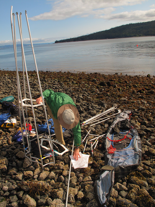
Doug assembles his folding kayak on a Yukon Island beach.

Approaching Elephant Rock.  This was the first destination of our trip.

Doug and Troy paddling near the entrance to Tutka Bay.

Out for an evening paddle.

Troy got a new stove for the trip.  It is easy to set-up and boils water in a flash.

Doug prepares dinner at Arch Beach.

The evening campfire at Arch beach.
Doug put the food bags out of reach of animals each evening.  We did see a bear just a couple hundred yards down the beach from our camp, but it never got any closer.

Repairing a broken rudder cable near Arch Beach.

Doug examines a sea star that was dangling from a rock after the tide went out.

Doug crouches to peer under a rock stuck in the arch.
The drinking fountain near Arch Beach.  It was a great water source.

Group photo just before we departed from Arch beach.

Troy and Doug paddling out of Arch Beach.

Troy at the entrance of Tutka Bay.  Hesketh Island is in the background.

All this gear fit in my kayak.

Our ride, the Bonnie Ann, pulling into Kayak Beach to pick us up.
The kayaks aboard the Bonnie Ann on our way to Yukon Island.

Three kayakers after a successful trip on the Bonnie Ann headed for Homer.