Thursday, June 30, 2011

...Skilak Lookout Trail

THE ROUTE: Skilak Lookout Trail
DISTANCE: ~5 miles round trip
TERRAIN: Old burn area of former spruce and cottonwood forest. Trail is wet and muddy in some areas. Last portion of trail to lookout area is steep.
A wild rose blooms along the Skilak Lookout Trail.
Remnants of a forest fire with Skilak Lake and the Kenai Mountains in the background.
A view near the end of the tail.
Laura and gabby take in the scenery during a break at the end of the trail.
Gabby, Emily, and Laura enjoying the break before we turn back toward the trailhead.
A bald eagle soared directly above us for about five minutes.
Mrs. Huffy and her camera.
The lookout view at the end of the Skilak Lookout Trail.
The Skilak Lookout Trail is a classic Kenai Peninsula hike. The trail passes through an area that was burned about 20 years ago and it is easy to see the remnants of charred spruce and cottonwood trees even though the vegetation has grown significantly since the fire. During this hike the area was covered with wildflowers of all types, but in the fall there is a profusion of many types of berries.
The trail itself is easy hiking until the end when it climbs rather steeply toward a knob with panoramic views of Skilak Lake and the Kenai Mountains. It is well worth the climb. As we sat admiring the views a bald eagle suddenly appeared and circled above us for the longest time. It soared on the stiff breeze coming off the lake and didn't once move its wings to stay aloft. It was a fitting way to enjoy our time at the end of he trail on...Skilak Lookout Trail.

Sunday, June 26, 2011

...Portage Valley

A map of some of our hikes and bike rides.
The view from our campsite. The clouds at the top of the mountain were not typical of our time at Williwaw Campground.
After dinner one evening we decided to hike up a ravine toward Middle Glacier, which we could see from our campsite.
This is the same ravine as in the previous photo, but you can see a family of four climbing toward the glacier in this picture. I added this photo for scale. It was a long way to the top. I don't think anyone went the entire distance.
A drooping flower.
An early morning scene from the Williwaw Nature Trail.
Mrs. Huffy and Emily enjoy riding their bikes on a portion of the Trail of Blue Ice.
This is the entrance to the tunnel. It is the longest tunnel in North America.
As we waited in the staging area for the tunnel to open in our direction lots of boats showed up. They were on their way to the dock at Whittier and the waters of Prince William Sound.
The tunnel to Whittier looks like this for most of its length.
The light at the end of the tunnel. Whittier is just beyond the opening.
At the Portage Pass trailhead.
Emily and Mrs. Huffy atop Portage Pass. They are making their way to a small bench that someone built to sit upon and take in the views. Whittier and Passage Canal can be seen in the distance. There was a huge cruise ship unloading and loading passengers at the Whittier dock. This pass has been used for hundreds of years to transport goods between Prince William Sound and Turnagain Arm.
Mrs. Huffy and Emily enjoy the bench and the fantastic views.
Looking the opposite direction you can see Portage Glacier and a portion of Portage Lake. The small body of water is called Divide Lake.
Emily made gourmet s'mores which included the usual graham crackers and marshmallows, but she also added a Reese's Peanut Butter Cup and a Kit-Kat bar to make it taste extra delicious.
My bike at the beginning of the Trail of Blue Ice near the Begich-Boggs Visitor Center.
Emily and Mrs. Huffy at the Byron Glacier trailhead.
Emily in her sunglasses with Byron Glacier in the background.
We drove to Girdwood to get some supplies and saw these kite surfers on Turnagain Arm.
We just returned from five nights at Williwaw Campground in the Portage Valley. The weather was spectacular and activities included a day trip to Anchorage, a trip through the tunnel to Whittier where we hiked to the top of Portage Pass, biking/hiking on the Trail of Blue Ice, and hiking on Byron Glacier Trail. We ate s'mores nightly around the campfire and played many games of Phase 10 at the picnic table. Emily got all her parents attention on this trip as Laura was on a week long trip to Kotlik--a small village on the Yukon-Kuskokwim delta. Gabby had a wonderful time chasing sticks and wading in the water at the ponds about a half mile from the campground. She also made many canine and human friends during our stay as she meandered through the campground on her leash on many walks. It was just another great trip to the...Portage Valley.

Sunday, June 19, 2011

...early morning on Thetis Lake

THE ROUTE: Kayak circumnavigation of Thetis Lake (red track on lake beside Island Lake on the map).
DISTANCE: 1.23 miles
TIME: 36 minutes

Kestrel and some Thetis Lake vegetation.


Kestrel waiting stern ashore.


Poised for the circumnavigation of Thetis Lake.


The image of a Kestrel on the bow of the kayak. Hence, the name Kestrel.


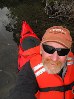
Self-portrait at the Thetis Lake access sign.


I woke up early this morning. Okay, nothing new there. So, after sitting around for a while and waiting for the newspaper to arrive I decided I should do something a little more constructive. I had thought of taking Kestrel to Thetis Lake more than once, but it is so close to where I live that I decided I could use it as a filler--a lake that wouldn't take much time to get to or circumnavigate. Today would be as good as any, I thought, so I loaded up the gear and took the short drive to the parking lot. I arrived just as it started to rain.

I considered taking the short drive back home, and as I sat there thinking, the rain stopped. I quickly plopped Kestral in with a splash and we were off to encircle Thetis Lake according to the plan. Things went swell. In 36 minutes we were back at the put-in and I loaded up just as the rain started again. Perfect timing and a perfect...early morning on Thetis Lake.

Saturday, June 18, 2011

...the lakes are waiting

THE ROUTE: Circumnavigation of Tirmore Lake.
DISTANCE: 1.33 miles.
TIME: 42 minutes.

Kestrel and a partially submerged tree on Tirmore Lake.


Self-portrait on Tirmore Lake.


Self-portrait at the Tirmore Lake public access sign on Holt-Lamplight Road.


Tirmore Lake is, for lack of a better word, tiny. It does have a public access point and there are several homes built on its edge, but it's only 1.33 miles around its perimeter, which makes for a quick paddle. Even at a leisurely pace. I did see a pair of loons nesting on the lake and several other types of water birds. The water depth around the edge of the lake is shallow, just several inches deep in many places, although I think it gets much deeper toward the middle. It is also a lake that is stocked with fish by the ADF&G. It was on my list of 23 lakes to circumnavigate in Kestrel this summer.


I'm not doing so well with my list. So far, I have only completed the circumnavigation of three of them: Island, Stormy, and Tirmore. I need to get in gear because time is passing and...the lakes are waiting.

Sunday, June 12, 2011

...a hike on Skyline Trail

THE ROUTE: Skyline Trailhead at the Sterling Highway to treeline.
DISTANCE: 1.8 miles R/T.
TERRAIN: Very steep! Hard pack, soft pack, mud, loose dirt/rocks.


The Hufford girls at the start of the hike.

Columbine.


Purple flowers.


Another purple flower.


Crossing a small stream on a wooden bridge.


Mrs. Huffy clings to the trail. It was very steep at this point and the dirt was very loose.


Laura found a tree to climb.


Skyline Trail used to be a regular hike for me. The drive to the trailhead is relatively short and the views from the top are fantastic. Twenty years ago I could run to the top and back down without a problem. Yesterday afternoon it was a little different. What a difference two decades can make. Somehow the trail was much more steep than I remembered it and the footing was much more tenuous. At least I can say the views were the same, just as spectacular as ever. We took it easy on the way up stopping many times for pictures of flowers that seemed to be in bloom for the first time. Laura and Emily had fun climbing tree root stairways and trees on the edge of the trail. We had to turn around at treeline in order to make it back to Kenai by 5:00 PM, so we didn't make it all the way to the top. We skidded and slid our way back down and before long we were back at the parking area. It was a beautiful afternoon and great to take...a hike on Skyline Trail.

Wednesday, June 8, 2011

...Stormy Lake kayak circumnavigation.

THE ROUTE: Circumnavigation of Stormy Lake via kayak.
DISTANCE: ~5.6 miles
TIME: ~2 hours
TERRAIN: Flat water with some chop at the south end of the lake.


Kestral and paddle ready for the circumnavigation.

The heavy weed beds around the southeast edge of the lake.


Another picture of the weed beds.


Kestral amongst the lily pads of Stormy Lake.


A narrow passage between a small island and the mainland. It was about 6-8 inches deep.


Self-portrait with the bow of Kestral at the end of the circumnavigation.


I took the kayak out to Stormy Lake this morning in perfect summer conditions. The sun was shining and there wasn't much more than a slight breeze to stir the water. It was very nice.


I started paddling and two hours later I was back at the boat ramp the circumnavigation complete. Along the way I saw several mergansers, a mallard, a loon, and a cow moose with a newborn calf. There were also some canoe campers at the Stormy Lake tent site. The time passed so quickly that I thought of going around again, but, alas, I loaded everything back into the truck and headed home, happy with an early morning...Stormy Lake kayak circumnavigation.